Canyon Log
| The canyon log is my chronological account of the various canyon
trips that I have been fortunate enough to partake, and in some cases,
lead.
Sydney is blessed with an abundance of rugged bush land less than two
hours drive away, and in this bush land lie some of the most pristine and
delicate environments that can be found.
Visiting these places may require no more than a simple walk along
a creek, or demand bush craft and navigation skills just to get there.
These trips are 'canyon' trips which involves starting high in the range
and following a creek or stream as it carves it's way down to the river
valley. The Kanangra canyons are generally fairly open and following these
is an exercise in abseiling and scrambling. The beauty of this area is
the panoramic views along the Kanangra Walls and valleys. The incredible
ruggedness of the area.
Blue Mountains canyons like Claustral, cut deep into the sandstone below
them and over time have worn channels and gutters, deep enough that direct
sunlight never reaches the bottom. Walking and swimming through these is
a magical tour through a ferny green wonderland. A visit to the lost planet.
I have kept these notes as a reminder to myself of the individual trips,
as well as to provide 'some' useful information for following excursions,
or to supply to others planning similar outings.
Earlier trips are documented on my original canyons
page, and other trips are indexed on my main canyoning page |
|
As I have been hap-hazardly adding pictures lately, these pages are
best viewed at a screen resolution of 1024 x 768 pixels !
Coachwood, Newnes
Sunday 28th January 2007
Vert. Elev: ___ (approx.)
Distance : ___ (approx.)
Time : 5 hrs (aprox.)
Comments: A nice short dry canyon. Good weather.
Crew:
Wit Cieslik
Denise 'Sparky' Black
Elain
Ben 'Bad Boy' Hazelton
Terry the 'Terrier' Eggington
Linda 'Leg's' Eggington
Steve Thomson
'Toronto' Rob, (from Toronto)
Min Ropes: 1 x 50m
All photos courtesy of Wit Cieslik, The Eggs and Elaine
|
Coachwood Canyon
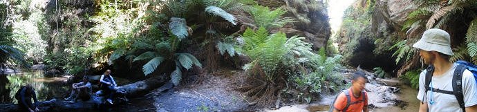 |
We found Coachwood to be, as decribed in the guide. A very nice canyon, with no swims and some trickling waterfalls.
The canyon starts with a pleasant walk through the upper section, populated with magnificent coachwoods, (I guess the name is a bit of a give-away!),
bordered by fantastic dry shear sandstone walls on each side, and cool ferny lunch caves.
We did manage to disturb a rather large brown snake sleeping in the ferny under-crap.
Walkers 1-2-3 missed it entirely,
but by the time No. 4 stepped over it, I guess it felt this disruption was never going to end,
and so made a hasty retreat,
giving it's position away to the 'surprise and delight' of No.4 and all following.
We missed the 1st abseil by scrambling down a rotting log on the left of the scrubby drop.
Not long after this, the 2nd abseil, (which can be done as two stages),
was reached and after rigging from a small tree on the right hand side of the upper drop, our group divided with some choosing the two stage approach,
and the others climbing down to the lower drop by using a handy ledge also on the right hand side, and abseiling the second stage only, from there. (There's not much scope for
an anchor on the second ledge. Possibly the logs in the pool, but you get a better pull-down from the anchor up above!). The second stage can be slippery.
The 3rd abseil has a loose steep start and anchor trees abound, (safety slings are a good idea).
The drop is stright down past a small dry overhang.
The 4th and final abseil is into Rocky Ck itself. There is a small neat pool at the start of this one,
which makes for good
fun inundating any beginners you may have abseiling. (Who can honestly say they've never done this ?).
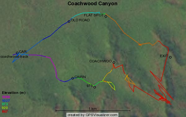
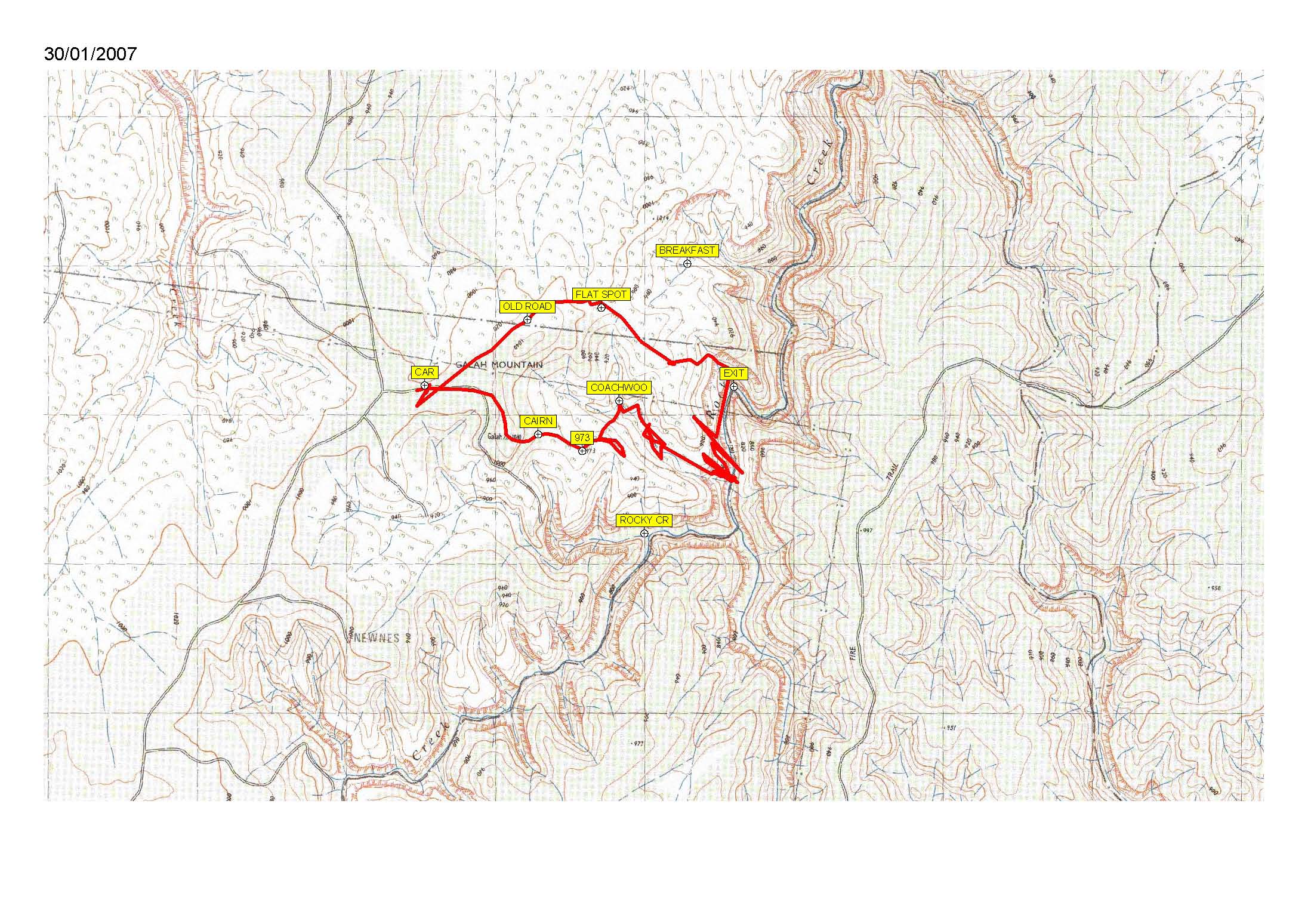
Navigation
As the canyon is a nice short one, we decided to fore go the approach description given in the guide and make our own,
based on the premise that we would be parking the cars at the old unmarked road, between the fork and the bend, well above
the Rocky Ck car park. This is the road we always re-emerge on after existing Rocky Ck, Breakfast Ck etc anyway.
From our car parking spot, we walked along Galah Mtn road towards the Rocky Ck car park, but left the road at the point where
it turns to the right. Instead we continued into the bush to gain the lightly wooded ridge, which we followed up to Galah Mtn trig.
From here we dropped down the steep side to gain the broad area beyond, and hence the sugested "973" spot marker.
Getting lazy, we followed the trail from this point for a few minutes, (instead of follwing the compass bearing).
A few minutes
later we realised we were heading almost entirely the opposite direction that we should have been going.
A communal group reversal, and a little brisk
striding back up the hill, followed by a course correction, and soon we were descending a neat little gully that dropped us
about 30m upstream from the start of the canyon.
Gear
We found the 50m rope adequate for even the two stage abseil, but two ropes will help speed up the process towards the end.
Our information on this area :
Other Sources of information on this area :
- Canyons Near Sydney Ed 3 (Rick Jamieson)
- Canyons Near Sydney Ed 4 (Rick Jamieson)
- Rock Hill map
- OzCanyons


EVP Home Page